Waterway Guide’s data is trusted by some of the most respected names in the boating industry, ensuring that our accurate and reliable information reaches boaters wherever they are. Our data delivery partners include leading brands like Raymarine, Aqua Map, and Savvy Navvy, who integrate Waterway Guide’s detailed charts, marina information, and navigation alerts into their products and services. By partnering with these industry leaders, we extend our reach and provide boaters with the essential data they need to navigate safely and efficiently, no matter which platform they choose.


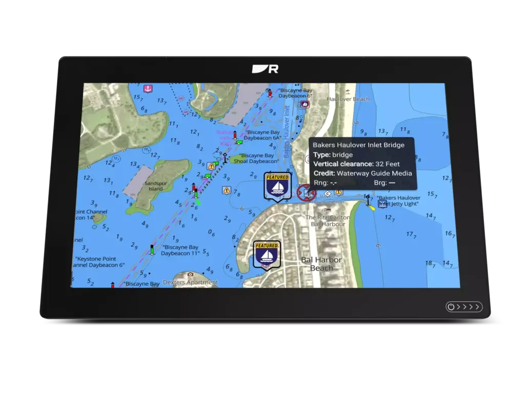
Following successful test and evaluation by Raymarine, data and information from Waterway Guide is now included in all Raymarine LightHouse Chart Premium subscriptions. Displayed on Raymarine chart plotters, LightHouse Charts offer a new level of clarity to marine GPS navigation.
Created from official hydrographic chart sources, LightHouse Charts offer maximum readability, intuitive navigation, and superior nautical chart quality. Four distinct color palettes provide the best possible viewing conditions around the clock, and chart symbol controls give you the power to customize the charts to your preference.
Waterway Guide president, Graham Jones, said, “We have been anticipating this release and are pleased to partner with Raymarine. Distribution of our data and points of interest to LightHouse Charts and other platforms reinforces our company’s commitment to safe boating with verified and timely information.”

When software engineers, cartographers, publishers and boaters get in a room together all sort of ideas begin percolating. That’s what Waterway Guide and Aqua Map teams have been doing for the past four years. Recognizing that both companies maintain important positions in the realm of navigation technologies and delivery platforms, the two have forged a strategic alliance dedicated to safe and informed boating.
The first effort for Aqua Map was to integrate Waterway Guide data points into their mobile navigation app. Using a simple application program interface (API) of data from Waterway Guide, the Aqua Map team created an easy-to-read and understandable presentation of information that includes Navigation Alerts, Anchorages, Bridges, Locks, Marinas, and Free Docks. The information is presented as symbols that overlay on the Aqua Map charts, with multilayered information embedded in each.

“One of the most significant factors in deciding where to go with your boat is reviews from other boaters. That’s why we’re super excited about our latest integration in our savvy navvy app in the US giving marina and anchorage information from Waterway Guide. With a wealth of information on all marinas and anchorages and honest reviews, it’s an amazing addition to our offering for our growing American customer base,” says Jelte Liebrand, CEO and Founder of savvy navvy.
Waterway Guide’s data is trusted by some of the most respected names in the boating industry, ensuring that our accurate and reliable information reaches boaters wherever they are.